Portfolio
This page is dedicated to projects I have worked on that I can talk about and I feel are representative of my work at the intersection of visual storytelling, urban planning, and geospatial analytics.
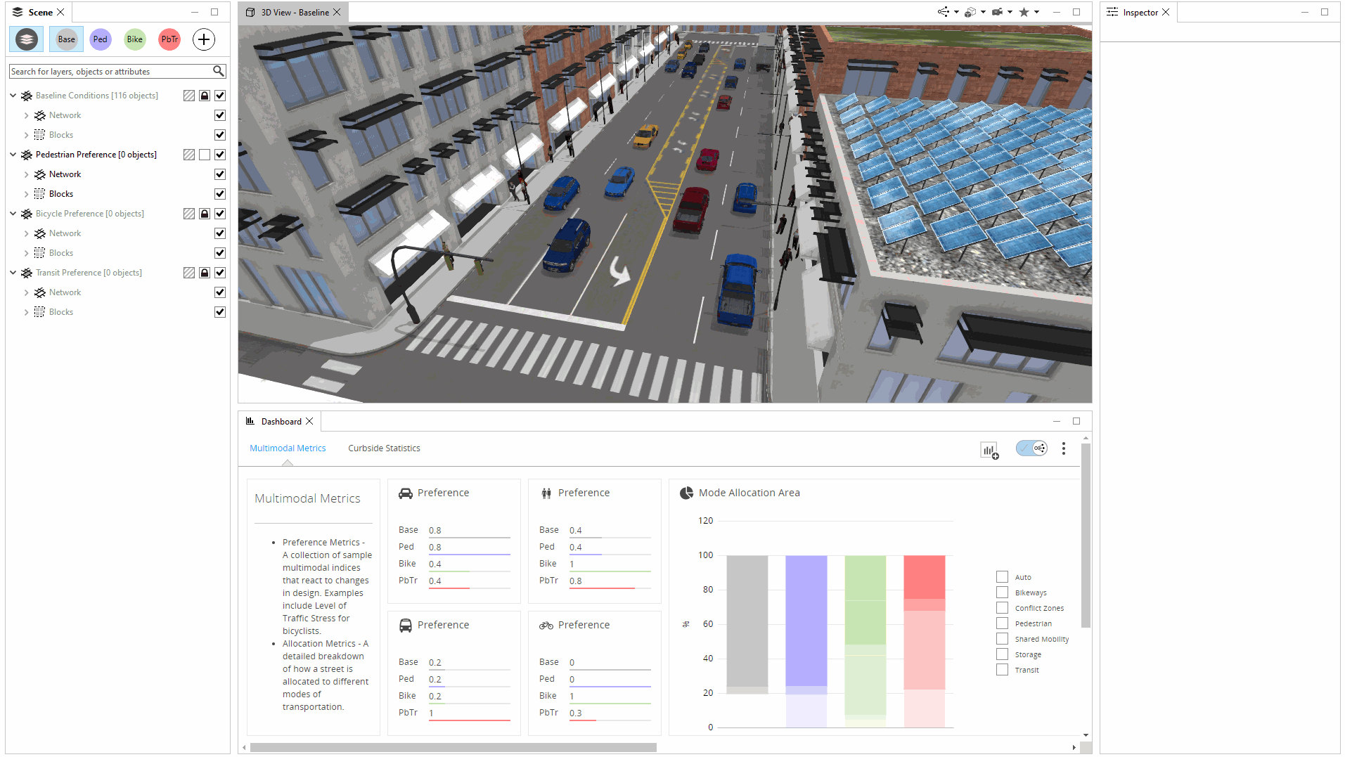
Complete Street Rule
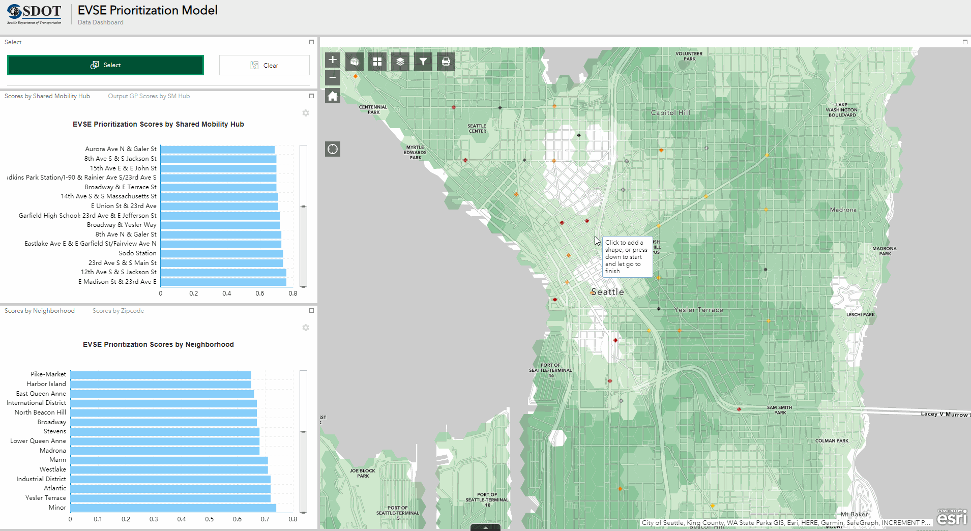
Seattle EV Charging Siting Study
Midvalley Active Transportation Plan
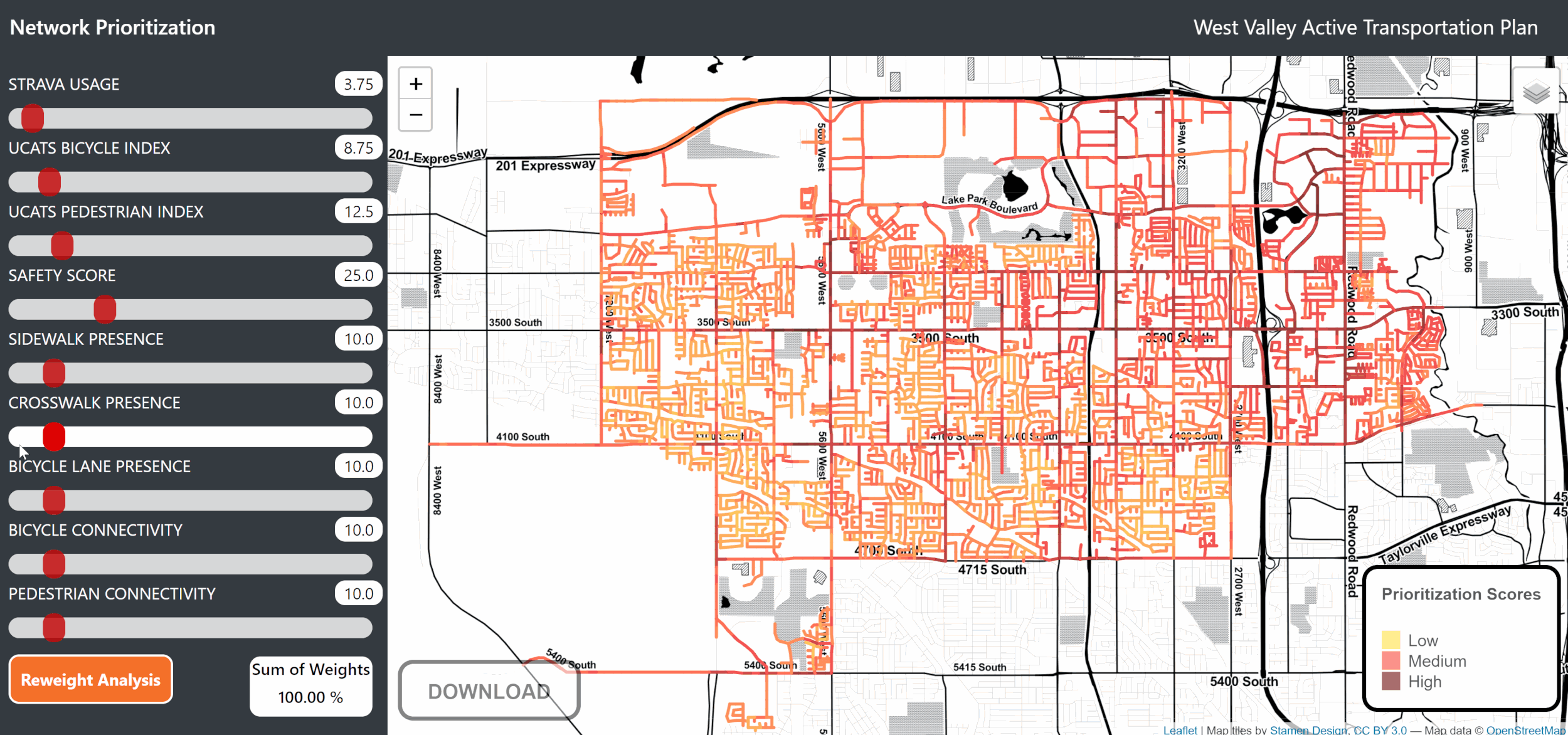
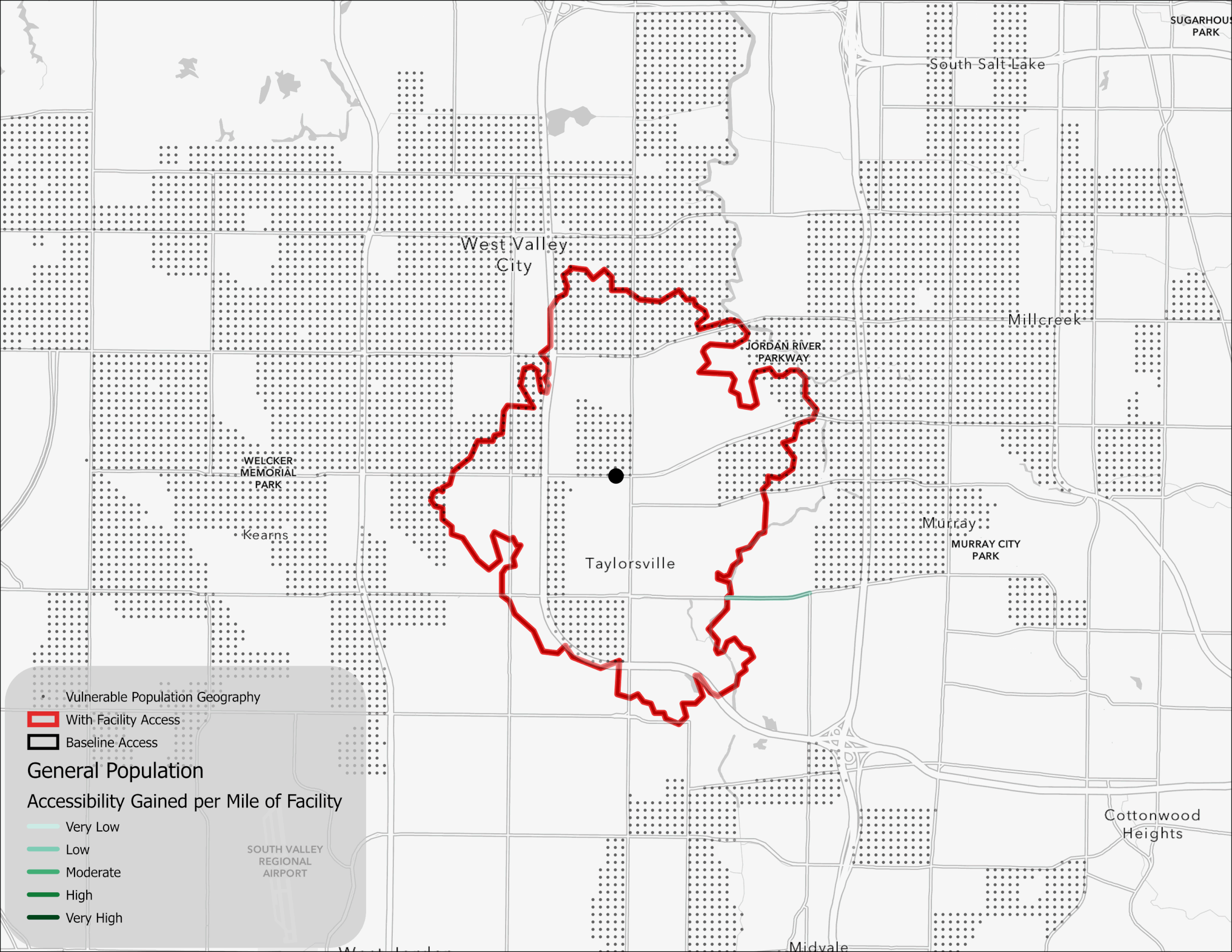
West Valley Active Transportation Plan
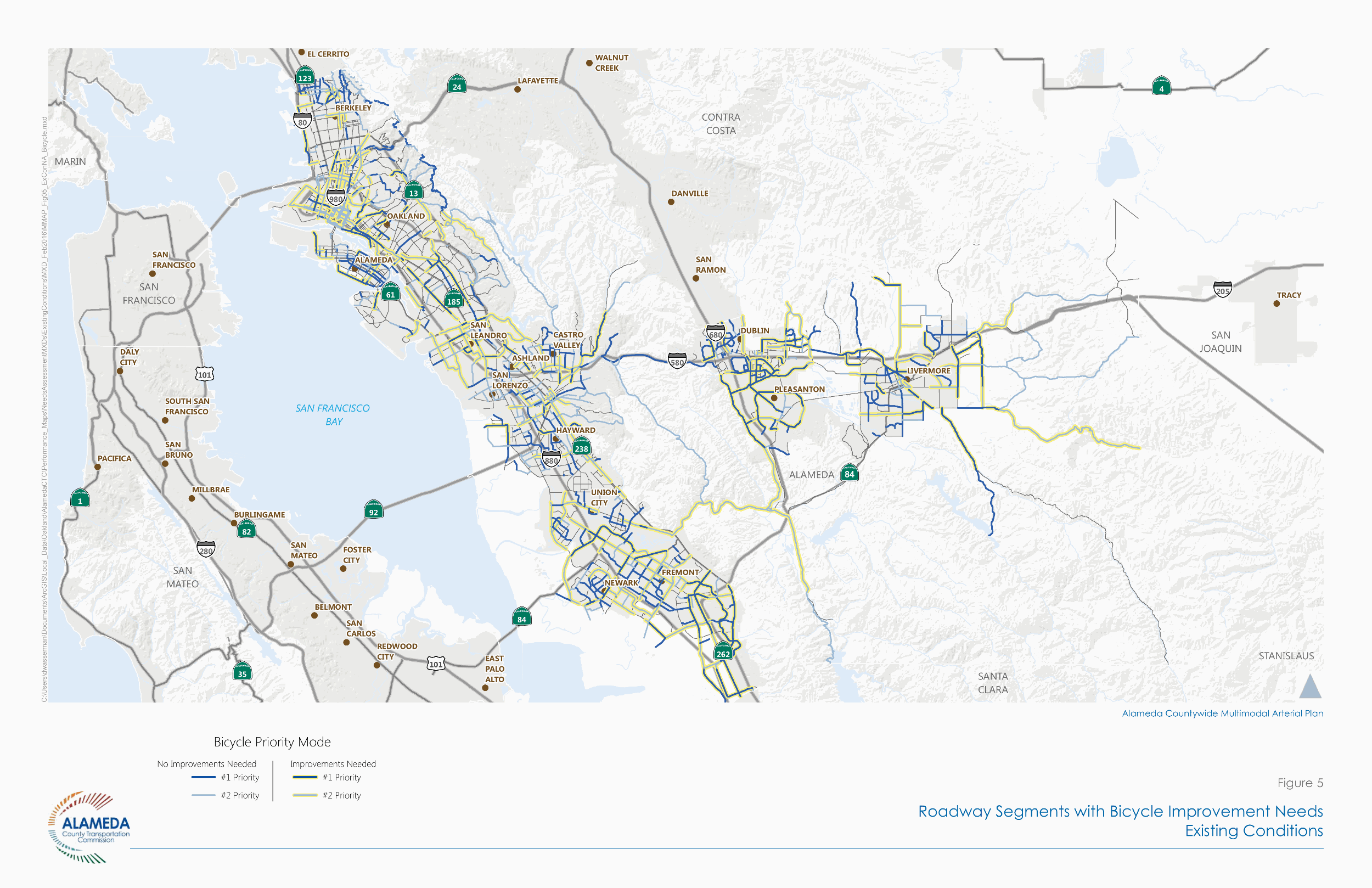
Alameda Multimodal Arterial Plan

National Micromobility Suitability Analysis
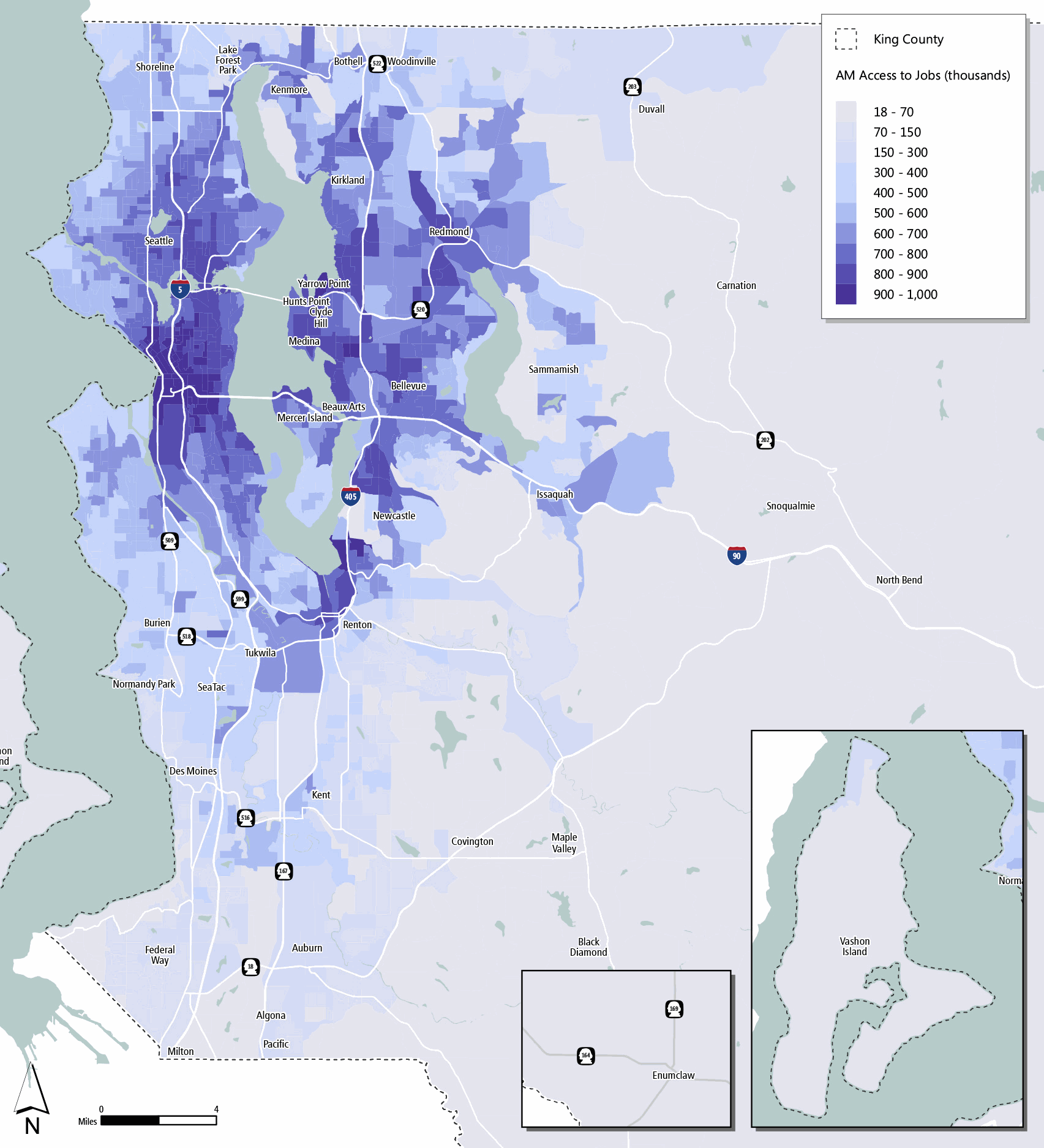
King County Metro Transit Mobility Framework

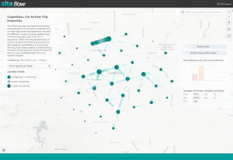
Santa Clara County Bike Plan Update (2018)

Marin SSAR and 2018 Travel Safety Plan
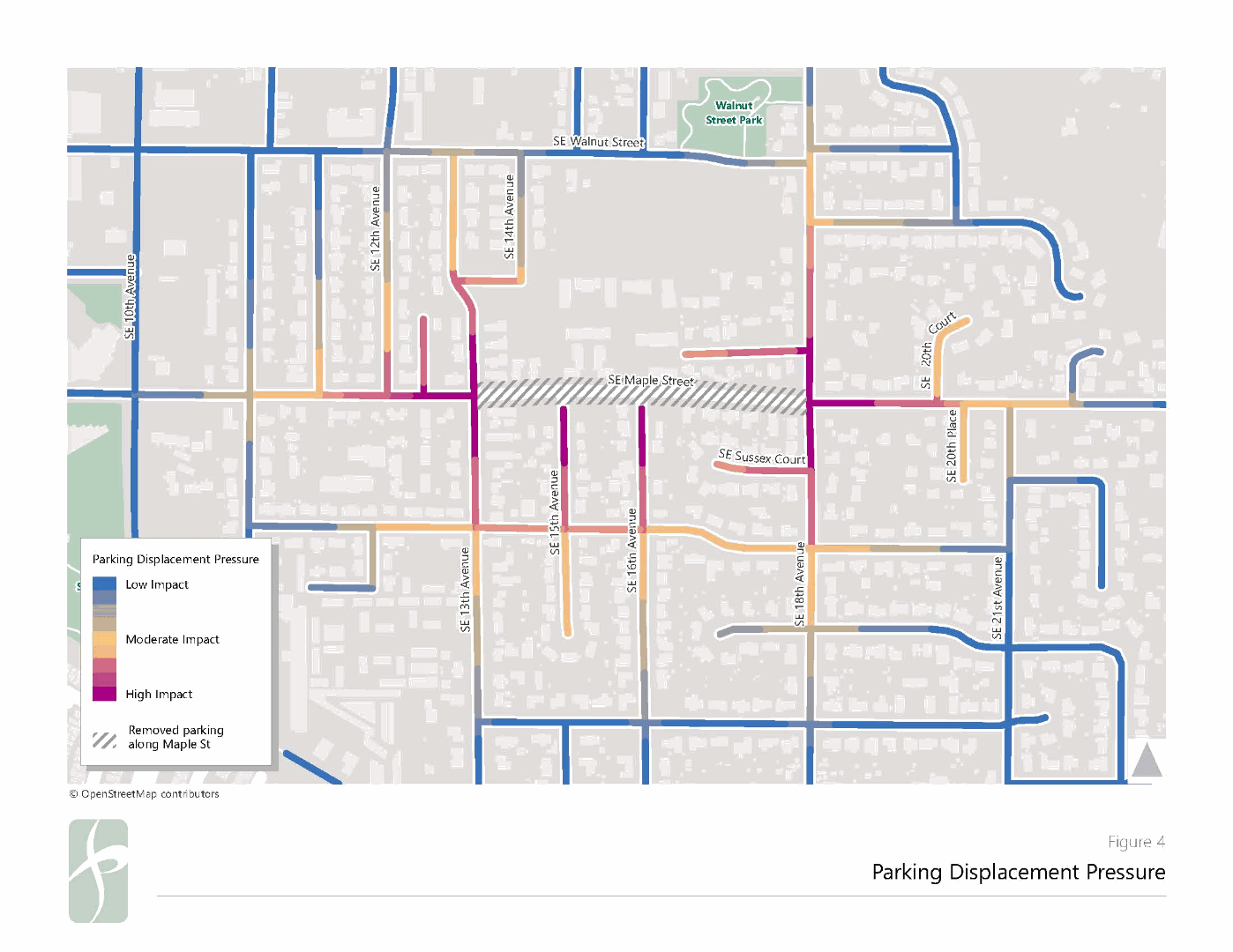
Maple Street Parking Displacement Study
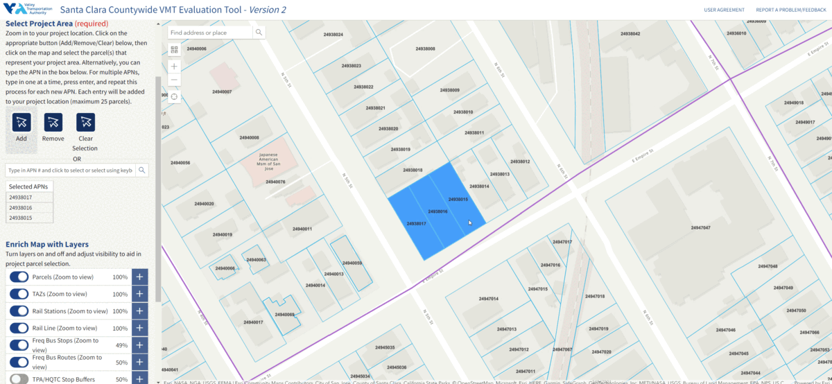
Santa Clara Countywide VMT Evaluation Tool
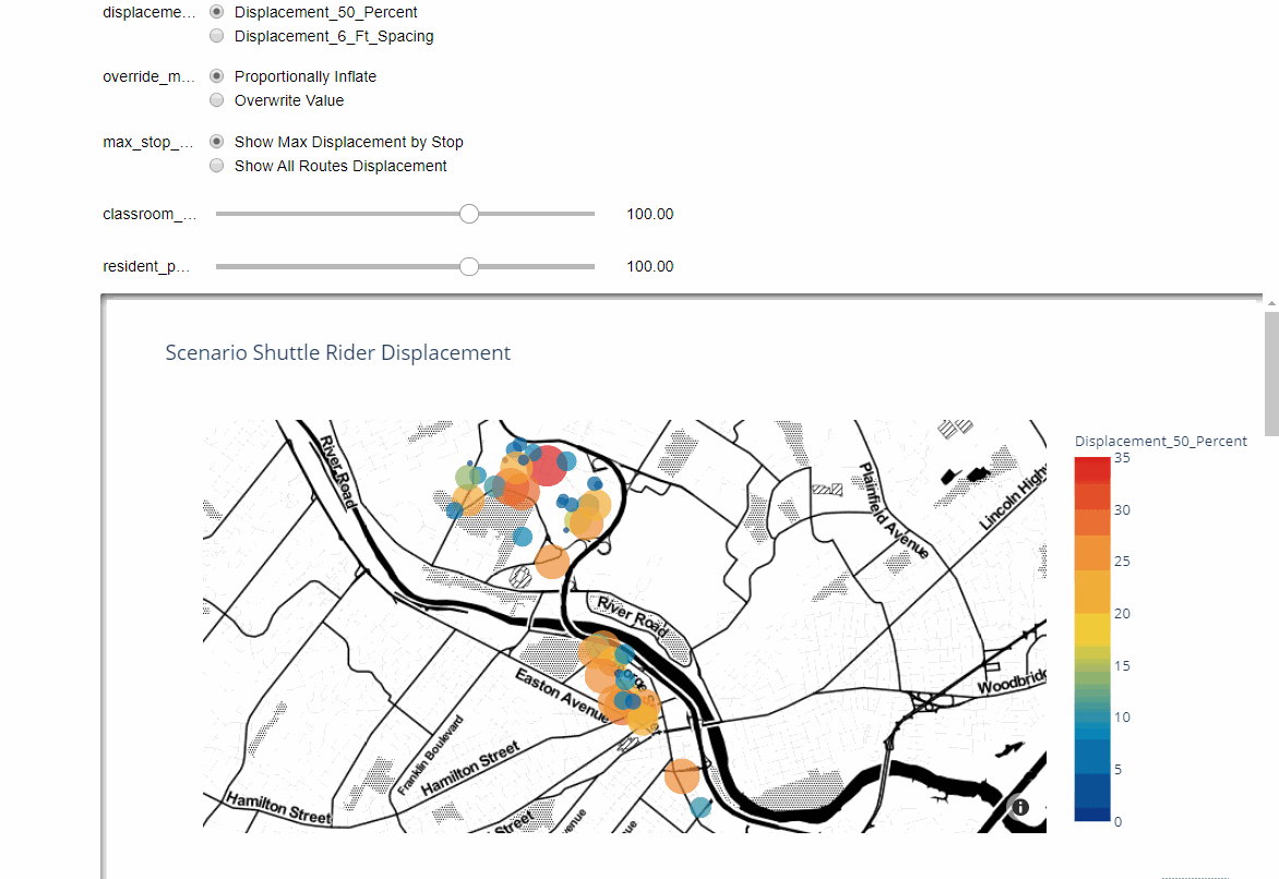
Rutgers Reopening Scenario Planning Tools
Great Springs Trail
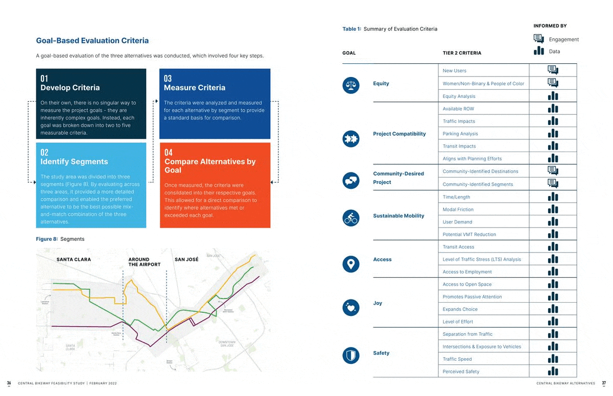
Central Bikeway Feasibility Study and Alternatives Analysis
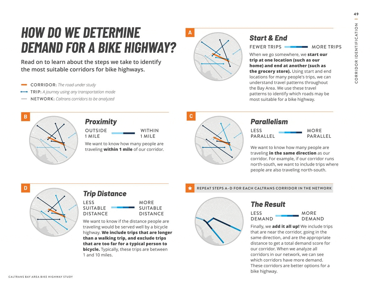
Caltrans Bay Area Bike Highway Study
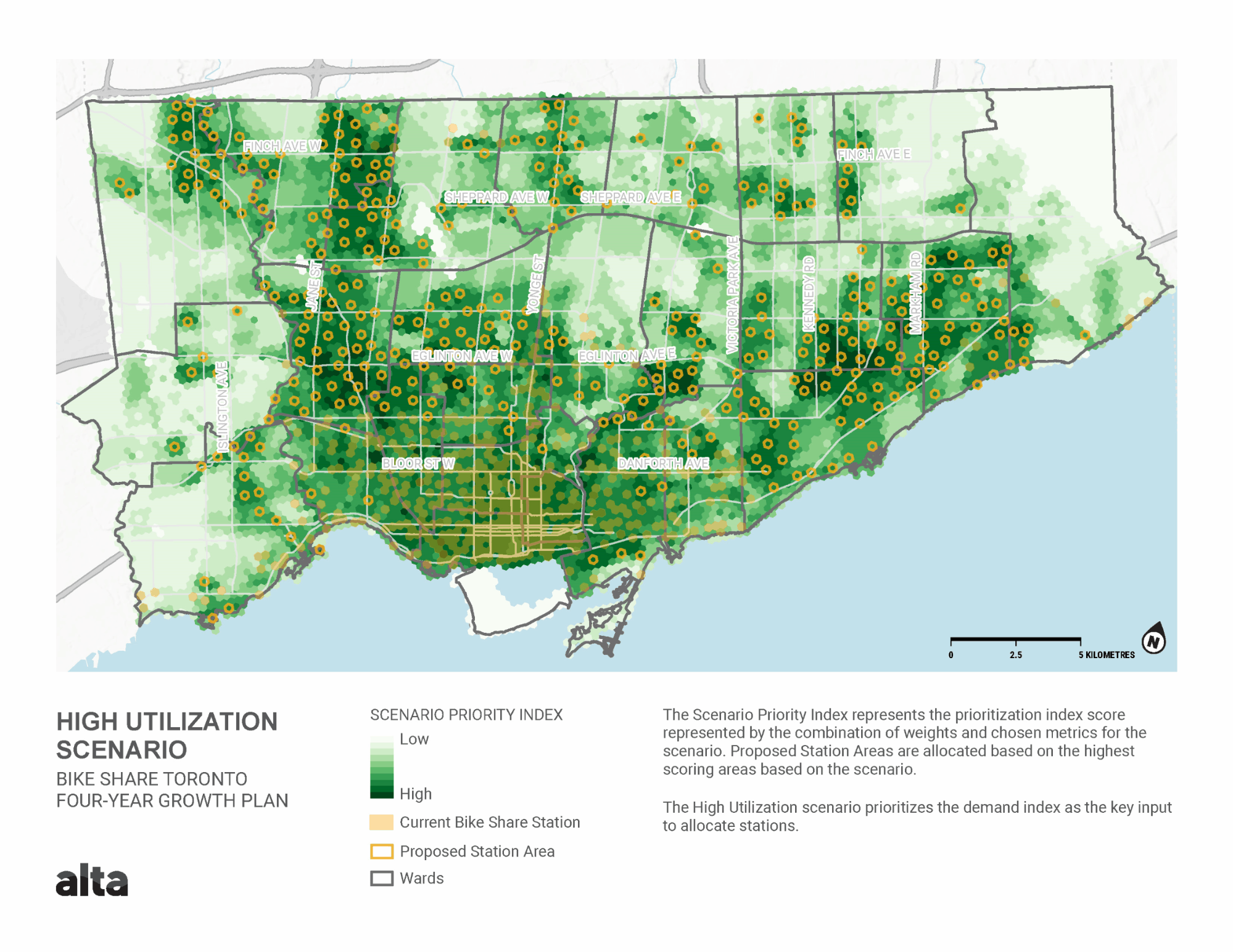
Toronto's Bike Share Expansion Plan
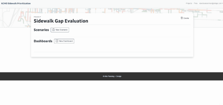
Kansas City Sidewalk Prioritization & Budgeted Prioritization Tool
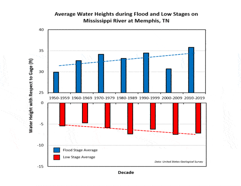
Big River PROTECT Grant

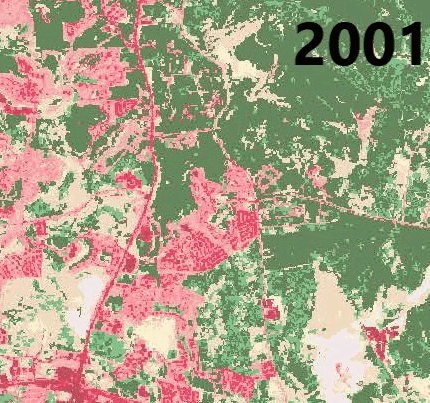
Sacramento Tree Opportunity Analysis